Digital imaging is the creation of digital images, typically from a physical scene. The term is often assumed to imply or include the processing, compression, storage, printing, and display of such images. Aerial Digital Imaging is the reconnaissance and surveillance that is usually conducted by unmanned aerial vehicles or reconnaissance aircraft. Their roles are to collect Imagery intelligence, Signals intelligence and Measurement and signature intelligence. Vihang Netra is an Air-bourne image acquisition system with a RF Link to Ground Station for Image and telemetry data display and logging in real-time mode. It specializes in low-altitude aerial imaging, from 50 feet to a few thousand feet.
Salient Features :
- MBTC Compression-Decompression engine
- Communication protocol - Image data packetization / depacketization
- Data Transmission and Reception using RF Transceiver
- Transfer of Image through PCI Bus to PC
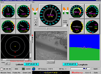
- Dash-Board Display
- CCIR-B Standard Video Generation
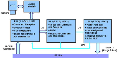
Block Diagram - Airbourne Unit :
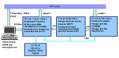
Block Diagram - Ground Station